
Google Earth is one of the most fascinating apps that exist today. Perhaps it is not as useful as Google Maps or WhatsApp for the common user, but it has many functions that can be used a lot. In fact, Google Earth is an excellent app to feed curiosity and kill boredom . And it is that from this platform it is possible to explore the seabed or ocean floor of our beautiful planet from the comfort of your mobile or PC.
Do you want to see the bottom of the most important bodies of water on Earth on your phone or computer? Soon we will explain how to do it with Google Earth. You will not only see the flora and fauna of the seabed from different parts of the world , but you will also be nourished with very interesting information about these bodies of water. All this without leaving Google Earth!
Steps to see the seabed in Google Earth from your mobile or PC
The first thing you have to do is make sure you have the Google Earth application installed on your mobile (it is not necessary if you are going to follow this tutorial on a PC). If you don’t have it, you can download it for free on your Android or iPhone mobile from any of the following boxes.


Once you have the app, follow these steps to explore the bottom of the sea:
- Click the following link to activate the Google Earth World Ocean layer .
- On mobile you will be asked if you want to open the link with Google Earth, so press OK .
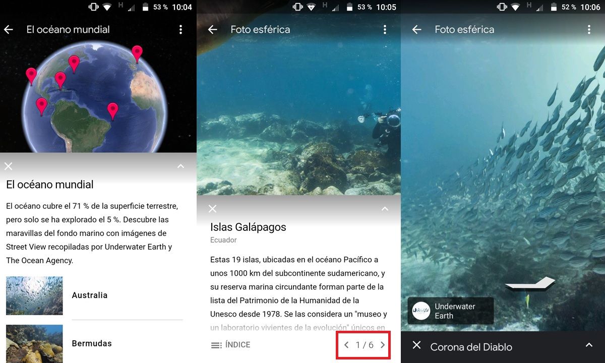
- Then, you will see the map in the app with marked points on the seabed that you can visit. In addition, a floating window entitled ” The World Ocean ” will be on view, which acts as an index of the oceans and seas that you can explore in Google Earth . Select from there the seabed you want to see.
- Next, you will enter the bottom of the chosen body of water with a window that will give you information about the place . You can close it by pressing the “X” to move as you like on the 360º panoramic photo of the seabed.
- Typically, a seabed has more than one spherical photo in Google Earth. You can find more photos to explore from the information window : at the bottom right there are some arrows to go from one image to another.
Clever! Now to enjoy the wonders that our planet treasures at the bottom of the oceans and seas. For more cool tricks like this, check out these 10 Google Maps 15th Anniversary Tricks.
