
When it comes to maps, most of us are satisfied with all the information and features that Google Maps offers. Some of us who are a little more curious may visit Google Earth from time to time, but we don’t need more. That does not happen in other areas such as geography, urban planning, science, meteorology and more.
These areas require specialized maps that are highly detailed and constantly updated. There are different options, but accessing them is not easy or cheap. However, Google wants to give these users a hand. How do you intend to do it? With Dynamic World: A Google Map to see how the world is changing , in near real time and with incredible accuracy.
Google’s Dynamic World shows you the use of the earth’s surface in fantastic detail
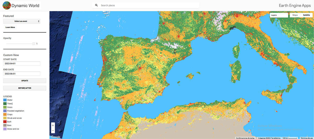
A partnership between Google and the World Resource Institute (WRI) resulted in the creation of Dynamic World, one of Google’s lesser known but useful platforms. The initiative mixes images from the Copernicus Sentinel-2 satellite with artificial intelligence (AI) to create the most detailed world map of what covers the earth’s surface.
Dynamic World allows you to zoom in up to 10 meters from the surface to find out if there is: water, crops, grass, buildings, snow or ice, bushes or bushes, flooded vegetation or if it is simply land with nothing in it. With this Google allows to show the use of soils from all over the planet, and the best thing is that it does it in an updated way.
Thanks to the satellite data provided by the WRI, the maps shown are practically in real time , something very difficult to achieve on other platforms. This is really useful as it allows researchers, scientists and even government institutions to know how climate change, a natural disaster or some human project is affecting the earth.
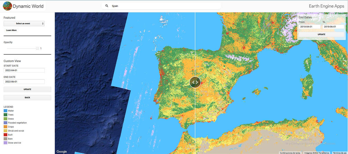
Besides, Dynamics World has a plus: it allows you to compare two specific moments of the same map to see how the terrain has changed. In addition, it uses a slider that allows you to quickly switch between the images you are comparing (before and after), something that makes it much easier to consult. This feature has an image database starting in June 2015.
Dynamic World is free and you can consult it from your mobile or computer
As you can see, Dynamic World from Google and the WRI is a fantastic platform that many specialized users will take advantage of. But the best of all is that anyone can consult the map for free from their mobile or computer .
Developers can access Dynamic World from Google Earth Engine to implement it on other platforms. However, there is also a web version that anyone can use from its official page .
Access | Google’s Dynamic World
What do you think of this new Google maps platform? I’m sure you’ve been fascinated, but going back to things a little less specialized, remember that Google Maps recently added several very useful features: the air quality layer, toll prices, immersive 3D views, traffic lights and more.
Source | Google
