

There may be alternative maps and GPS navigation applications, but without a doubt Google Maps is one of the most complete . Its developers add new features from time to time that make our lives a lot easier: like the recent inclusion of traffic lights, the map of the busiest areas, and even routes where you’ll save gas.
However, there is also room for more ‘curious’ features, like the one they recently added. Google Maps now allows you to see the air quality of a place directly from the app and we want to show you how to check it in this little tutorial.
Check with Google Maps if the air in your city is clean or polluted
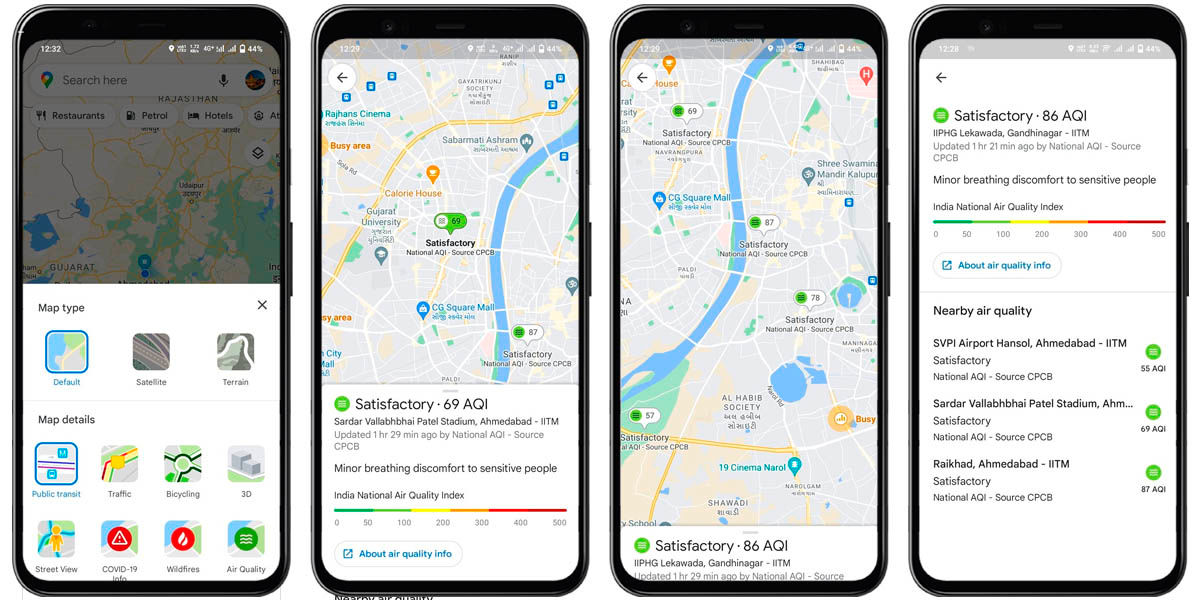
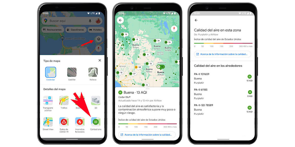
Are you an environmentalist? Do you like to know how clean or polluted is the air you breathe in your city? So, ‘Air quality’ is a feature of Google Maps that will interest you a lot. The latest version of Maps added a new navigation layer where you can see how good (or bad) the air you’re breathing is when you’re away from home.
The layer uses the Air Quality Index (AQI) , a scale that starts at 0 for very clean air and increases as pollution worsens. In fact, Maps will also display a color scale based on the value:
- 0 to 50 points (green) : clean air.
- 51 to 100 points (yellow) : air of fair quality.
- 101 to 150 (orange) : contamination harmful to sensitive groups.
- 151 to 200 (red) : air harmful to everyone’s health.
- 201 to 300 or more (carmine) : contamination very harmful to health.
- 301 to 400 or more (Maroon) : Extreme contamination.
Google takes this data from government agencies, as well as the PurpleAir sensor network, so it’s pretty reliable. In addition, the app indicates when the AQI was last updated in each area, as well as links to content of interest. This feature may not surprise some people, as there are numerous apps specialized in this type of information. However, the fact that it is integrated directly into Google Maps is a great advantage: less storage space occupied and one less app on your mobile.
How to activate ‘Air Quality’ in Google Maps for Android and iOS
This new feature of Maps is already available in India and the United States , but Google confirmed that its distribution to other countries has already begun. It will be a process that will take a few days to cover all users, but we are already telling you how to activate this novelty. All you have to do is the following:
- Open Google Maps and locate yourself in the place you want to consult.
- Click on the ‘Navigation Layers’ button (usually it’s above the compass icon, it’s the one with the boxes overlapping each other).
- The navigation layers menu will open, go to the ‘Map details’ section .
- Select ‘Air quality’ .
As simple as we just explained. Once you do, you will be able to see all the information that Maps has for you about the air quality in your town or almost any other point on the planet . Be careful, we say “almost” because some areas and countries do not have this information.
Have you already tried this new feature of Google Maps?
More information | Google
